Saturday, April 16, 2011

Mooloolaba–9 to 15 April 2011

2011.04.08 at 09h33m10s Clarence River Ferry2011.04.08 at 09h30m10s Clarence River FerryThere are a great deal to many O's in this part of the coast!!  From Woolgoolga we returned to Mooloolaba.

As there was an accident blocking the Pacific Highway after Grafton, we took the alternate route using the  ferry crossing between Lawrence and Woodford. 

We passed through Maclean, which celebrates its Scottish heritage by painting each telephone pole with a separate clan tartan.

2011.04.13 at 07h51m25s Mooloolaba - 11-04 Queensland2011.04.08 at 10h31m35s MacleanIt has a great coffee shop attached to the coffee roasting business espresso Botero.

Back in Mooloolaba we resumed our routine of walks and swims, while enjoying the million dollar views of our beachfront location. 

We visited with our friends, cleaned the van and had the car serviced.  We arranged to have the caravan serviced while we are away in the USA to visit our children.

2011.04.09 at 11h19m26s Mooloolaba - 11-04 Queensland

Saturday, April 9, 2011

Woolgoolga - 31 March to 8 April 2011

2011.04.03 at 11h51m16s Woolgoolga2011.04.07 at 14h51m01s WoolgoolgaThere are two lovely Council Camping Parks in Woolgoolga, both on the beach.  The Ocean park is near the Surf Lifesaving Club.  The River Park is where the river meets the sea. We have a great site in the Ocean Park right on the main surf beach.

We can watch the surfers hovering on their surfboards and see the people come and go.

The Beach Report says it all: “WELCOME TO: PARADISE  CONDITIONS: MAGNIFICENT!”

2011.04.06 at 09h51m05s Woolgoolga

The town has a pleasant atmosphere with a couple of great cafes and where would we be without Bluebottles mirroring our favourite coffee shop from San Francisco. 2011.04.07 at 11h17m26s WoolgoolgaThe Saturday market is excellent with some very good quality and original local craft.

This town has a large Sikh presence dating back to the days when the Sikh’s came to Australia as camel handlers, hence the term Afghans and the Ghan railway.  Subsequent arrivals came to work on the banana plantations in Queensland.

We spent our time swimming, bike  riding and walking. Woolgoolga is a lovely place to stop. The Headland is a good place to watch for whales in the season and the waters around here are part of the Solitary Islands Marine Park.

2011.04.04 at 15h03m58s Woolgoolga

Thursday, April 7, 2011

Coffs Harbour–6 April 2011

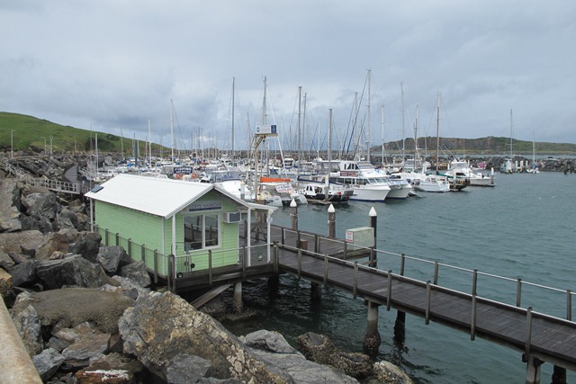
2011.04.06 at 13h36m02s Coffs Harbour2011.04.06 at 14h06m47s Coffs HarbourOne rainy day we headed into Coffs Harbour.  Coffs is the largest rural town in the vicinity and also a popular tourist city in season.  Most of the towns around here primarily serviced  the timber industry and are now agrarian.

We visited the harbor and then went for a walk on Muttonbird Island.  Mutton birds here are Wedge Tailed Shearwaters and they use various isolated places or islands on the coast to breed.  The Shearwaters on this Island have been under threat from various predators as the breakwater has joined  the Island to the mainland thus allowing  foot traffic onto the Island.  Rats from the ships, cats, dogs and people all take their toll on the nesting Shearwaters as the burrows are flimsy and will collapse if you walk on them and rats and 2011.04.06 at 13h43m59s Coffs Harbourdogs steal the eggs and eat the nestlings.  The name Muttonbird is self explanatory and they probably fed many a hungry settler.

Both parents share the care of the chicks.  We weren't there late enough in the day, but if you wait till dusk the sight of the birds returning to their nests to feed their chick and mate is a marvelous sight. We have seen it at other nesting sites in Australia.


2011.04.06 at 14h06m00s Coffs Harbour

We had a rather wet walk along the Island to the lookout over the Solitary Islands Marine Park.  Then dripping wet we did our shopping and dried out in the car on the way home to the van.

Saturday, April 2, 2011

Byron Bay [the most Easterly Point] – 1 April 2011

2011.04.01 at 12h45m50s Byron BayWe have been lucky with the weather but even the most charmed trip has to have some rain. The second day we were in Woolgoolga it rained and as we had been to the most westerly point of Australia at Steep Point we decided to go to the most Easterly Point of Australia at Byron Bay.

The history of white settlement at Byron Bay began in 1770 when Captain James Cook found a safe anchorage and named Cape Byron after John Byron. Byron Bay began as a struggling working class town but as industries closed and the smell went surfers began coming for the fantastic surf breaks. In 1973 following the Aquarius festival at Nimbin its reputation as a hippy, happy alternative town was firmly established. It is rather touristic now but the coast is still stunning.

The lighthouse was built on (nearly) the most Easterly Point on Cape Byron. This is one of a chain of lighthouses protecting mariners down this coast.
We had lunch at Fish Heads Cafe once the original bathing pavilion and change rooms and drove to the lighthouse. We stood at the nearly most Easterly Point and then walked down the headland. The lighthouse keepers houses are a popular place for weddings, gliders and hang gliders.

2011.04.01 at 13h34m58s Byron Bay


2011.04.01 at 12h48m13s Byron Bay2011.04.01 at 13h42m59s Byron Bay2011.04.01 at 14h02m50s Byron Bay2011.04.01 at 14h31m55s Byron Bay

Thursday, March 31, 2011

Nambucca Heads–29 to 30 March 2011

Reluctantly we left Dorrigo for our next destination. We stopped at Bellingen on the Bellinger river for lunch.
We bought excellent bread from Hearth Fire Bakery and walked the town.

2011.03.29 at 11h51m17s BellingenAfter lunch we drove down to Nambucca Heads. Nambucca is an old timber town on the Nambucca River. Nambucca is thought to come from an aboriginal word meaning entrance to the waters.

2011.03.29 at 16h04m31s Nambucca Heads 2011.03.30 at 13h56m52s Nambucca Heads

We had a lovely site facing onto the lagoon. We did the River Walk down the Nambucca River. The breakwater is called the V wall. One can memorialize almost anything here. We found it very touching. 2011.03.30 at 17h45m56s Nambucca Heads
2011.03.30 at 16h02m37s Nambucca Heads2011.03.29 at 15h57m32s Nambucca Heads2011.03.29 at 16h55m05s Nambucca Heads

2011.03.29 at 16h58m26s Nambucca Heads

Wednesday, March 30, 2011

Dorrigo–24 to 29 March 2011

Our friend Sidsel lives on a 30 acre property adjoining Junuy Juluum  National Park in Dorrigo.  Dorrigo is an attractive town on the escarpment, a caldera of an extinct volcano and the beginning of the rich farming area known as New England.  Most of the Dorrigo area was clear felled for timber and then used for potato and dairy farms.

Some virgin rainforest was left and the rainforest is regenerating in areas unsuitable for farming or as tree changers buy a property and allow it to return to nature.

2011.03.29 at 09h51m58s Bushtracker, Dorrigo2011.03.29 at 10h41m10s Dorrigo2011.03.29 at 10h56m00s Dorrigo

This is a really beautiful part of the world with wonderful views from the escarpment.  We visited the Skywalk in the Dorrigo National Park which has a platform built over the forest canopy, a great series of walks and a cafe. By chance we met a friend from long ago at lunch. This was an unexpected pleasure, two old friends in one place.

We drove the Moonpar Forest 4WD track and we walked through the Norman Jolly Grove. This is virgin rainforest, left for future generations so we can see what pre white settlement Australia looked like. We saw Platypus Flats a great place to camp or picnic by the Nymboida River.

2011.03.25 at 12h22m19s Skywalk2011.03.25 at 12h26m35s Skywalk2011.03.26 at 14h33m32s Norman Jolly Forest Reserve

2011.03.26 at 14h31m09s Norman Jolly Forest Reserve2011.03.26 at 14h36m13s Norman Jolly Forest Reserve2011.03.28 at 13h51m03s Dorrigo


We fed Sidsel's almost tame wallabies with macropod food, chased the python off the road so it was not run over and had a lovely time catching up.

2011.03.28 at 15h24m03s Dorrigo

2011.03.24 at 14h56m28s Dorrigo2011.03.29 at 09h40m50s Dorrigo

Friday, March 25, 2011

Yamba [via Fingal Head, Hastings Pt, Evans Head] – 20 to 24 March 2011

2011.03.20 at 16h18m17s Fingal HeadWe drove the Tweed Heads Way part of which is the old Pacific Highway and walked to the Lighthouse at Fingals Head. We overnighted at Hastings Point and then drove through Byron Bay with lunch overlooking a surf break at Evans Head before arriving at Yamba.
2011.03.20 at 16h21m03s Fingal Head-42011.03.21 at 13h56m57s Evans Head
2011.03.21 at 16h32m45s YambaYamba is a nice little fishing village where we camped on the Clarence River.
Just up the road is Angourie which is supposed to have the best Point Break in Australia. Surfers can be seen hugging the headland waiting for the perfect wave, like the pot of gold at the end of the rainbow.
2011.03.22 at 16h13m28s Angourie-4

Yamba was a major port but has now been overtaken by Grafton. It is amazing to see the various rock walls used to 'train' the current effectively self dredging the river. After over a hundred years of work the scheme was perfected, just in time for the decline in coastal shipping services, although the shipping service to Lord Howe Island still uses the Port.
2011.03.22 at 13h08m30s Iluka2011.03.24 at 06h00m22s Yamba
There is a ferry service between Yamba and Iluka, the villages on each side of the mouth of the Clarence River. We took the ferry to Iluka, walked the ocean walk and watched the thousands of little blue swimmer crabs scurrying around the sand. A popular boat type were outriggers made out of corrugated iron. One was called MV Roof.
2011.03.22 at 12h36m42s Iluka2011.03.22 at 14h08m01s Iluka2011.03.22 at 14h30m28s Iluka
We also took a cruise to the Bridge at Grafton on one of the ferries. This is sugar cane country, flat and pleasant. On the night of 19 March the moon was at its closest to earth since 1992.
2011.03.21 at 19h41m36s Yamba2011.03.23 at 12h05m23s Clarence River Cruise

We visited the Blue Hole and Green Hole at Angourie, the remains of two quarries used to supply rock for the river walls until they finally hit an underground spring and filled up with water.

2011.03.22 at 16h22m59s Angourie
2011.03.22 at 16h13m02s Angourie